- Services
- All Services
- All Locations
- Surveying
- Drone Infrastructure Services
- Drone Services for Agriculture
- Drone Inspection for Cell Towers
- Drone Media Services
- Drone Mapping Services
- Drone Mining Inspection
- Drone for Surveillance And Security
- Industrial Robotics and Unmanned Systems
- Semiconductor Design and Innovation Services
- Factory Automation Solutions
- Portfolio
- Unmanned Products
- Drone Training
- Blog
- Brochure
- Contact us
RTK and PPK in Precision Drone Mapping Are Redefining Survey Accuracy
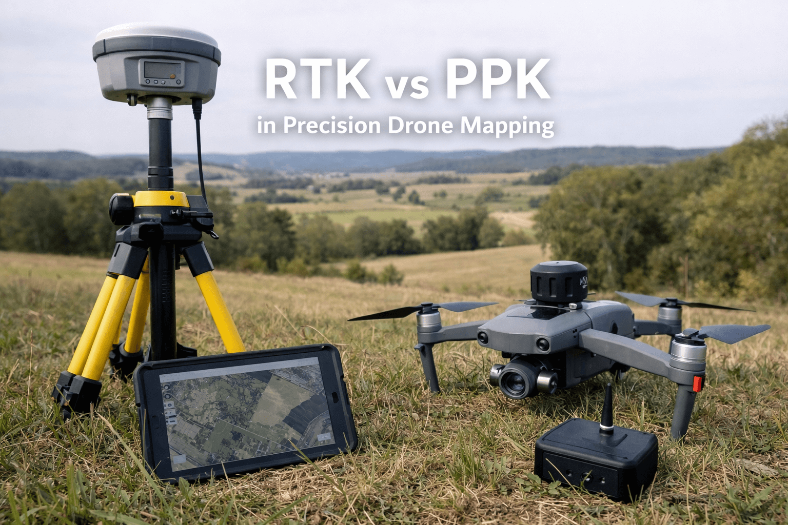
RTK and PPK in precision drone mapping have become essential technologies for delivering centimeter-level accuracy in aerial surveys. As industries increasingly rely on drone data for infrastructure development, construction planning, mining operations, and urban mapping, the demand for highly accurate geospatial data has never been greater.
Traditional GPS systems provide general positioning accuracy, but they often fall short for professional surveying standards. That’s where RTK (Real-Time Kinematic) and PPK (Post-Processed Kinematic) corrections significantly enhance precision and reliability.
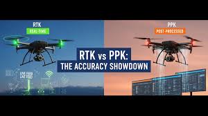
Understanding RTK and PPK Technology
To fully appreciate how RTK and PPK in precision drone mapping improve accuracy, it’s important to understand how these systems work.
What Is RTK?
RTK uses a base station that transmits real-time correction data to the drone during flight. This allows the drone to adjust its GPS positioning instantly, achieving centimeter-level accuracy.
What Is PPK?
PPK, on the other hand, collects raw positioning data during the flight and applies corrections afterward during post-processing. This method provides flexibility and ensures accuracy even if connectivity is interrupted during the mission.
Both systems correct satellite positioning errors caused by atmospheric disturbances, signal interference, and clock inaccuracies.
Why Accuracy Matters in Drone Mapping
High-precision mapping is critical in projects where even small measurement errors can lead to significant cost overruns. RTK and PPK in precision drone mapping help eliminate inaccuracies that could affect:
- Construction layout planning
- Corridor and highway alignment
- Mining stockpile volume calculations
- Infrastructure inspection reports
- Topographic and contour mapping
With improved positioning accuracy, project teams can make confident decisions based on reliable data.
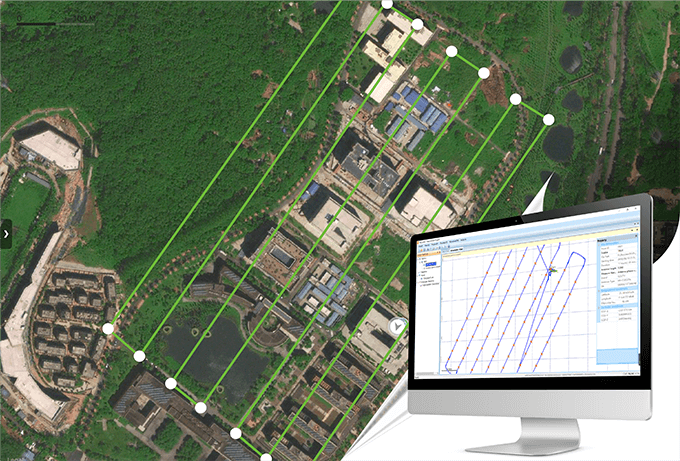
How RTK and PPK Improve Precision
1. Centimeter-Level Positioning
By correcting GPS errors in real time or post-processing, RTK and PPK in precision drone mapping reduce positional deviations dramatically.
2. Reduced Ground Control Points (GCPs)
Traditional drone surveys often require numerous ground control points to achieve high accuracy. RTK and PPK significantly reduce or sometimes eliminate the need for GCPs, saving time and labor.
3. Consistent Data Quality
Both correction methods ensure uniform accuracy across the entire survey area, which is essential for large-scale projects.
4. Enhanced Reliability in Challenging Environments
In areas with limited internet connectivity, PPK offers a reliable alternative since corrections are applied after the flight.
5. Faster Project Completion
With fewer manual corrections required, workflows become more efficient, accelerating project timelines.
Industry Applications of RTK and PPK
The adoption of RTK and PPK in precision drone mapping is expanding across industries:
Construction
Precise site grading and foundation planning.
Mining
Accurate stockpile volume measurements.
Infrastructure
Highway, railway, and pipeline corridor mapping.
Agriculture
Field boundary mapping and terrain modeling.
Urban Planning
High-accuracy 3D city models.
These applications demonstrate how advanced GPS correction methods enhance project performance.
The Future of High-Precision Drone Mapping
As drone technology continues to evolve, RTK and PPK in precision drone mapping will integrate further with AI-driven analytics, cloud processing, and autonomous flight systems. Innovations such as multi-frequency GNSS support and real-time data streaming will push accuracy standards even higher.
With increasing demand for smart infrastructure and digital twin models, precision mapping solutions will remain at the forefront of geospatial innovation.
Conclusion
Accuracy is the foundation of successful aerial surveying. RTK and PPK in precision provide the reliability and precision required for modern infrastructure, construction, and environmental projects.
By minimizing GPS errors, reducing dependency on ground control points, and improving workflow efficiency, these technologies empower drone service providers to deliver professional-grade mapping solutions. As industries continue to demand better data, RTK and PPK will remain essential tools in precision drone mapping.