- Services
- All Services
- All Locations
- Surveying
- Drone Infrastructure Services
- Drone Services for Agriculture
- Drone Inspection for Cell Towers
- Drone Media Services
- Drone Mapping Services
- Drone Mining Inspection
- Drone for Surveillance And Security
- Industrial Robotics and Unmanned Systems
- Semiconductor Design and Innovation Services
- Factory Automation Solutions
- Portfolio
- Unmanned Products
- Drone Training
- Blog
- Brochure
- Contact us
Real-Time Analytics in Drone Mapping Is Transforming Aerial Intelligence
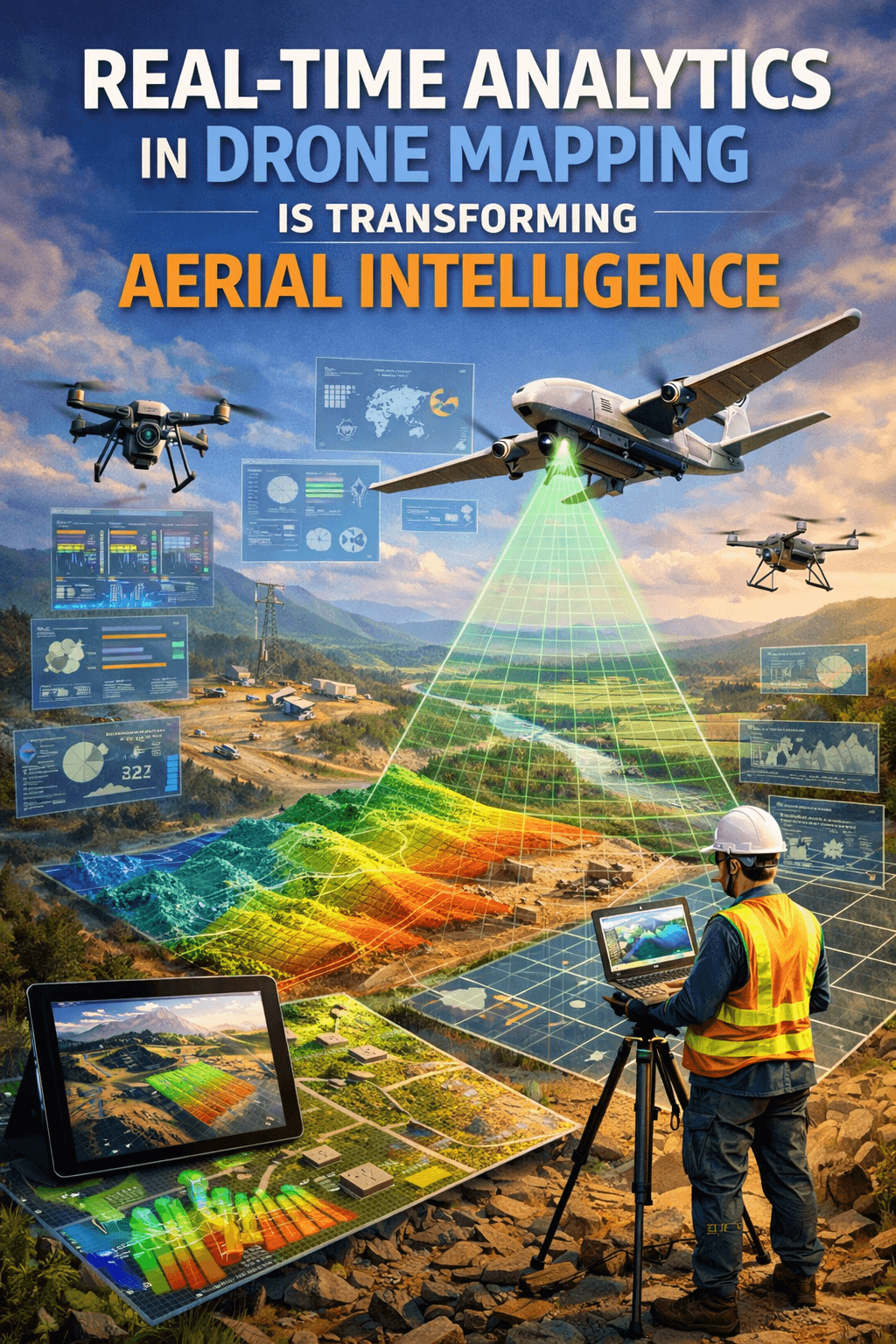
Real-time analytics in drone mapping is changing the way industries collect, process, and use geospatial data. Traditionally, drone surveys required hours or even days of post-processing before actionable insights could be generated. Today, with advanced cloud platforms and intelligent processing tools, data captured in the field can be analyzed almost instantly.
For industries such as construction, mining, infrastructure, agriculture, and urban planning, this shift toward immediate data access is a game changer. Faster analysis means quicker decisions, improved efficiency, and reduced operational risks.

What Is Real-Time Analytics in Drone Mapping?
Real-time analytics in drone mapping refers to the ability to process and interpret aerial data immediately after—or even during—a drone flight. Instead of waiting for manual downloads and desktop-based software processing, cloud-integrated systems automatically upload captured data for instant analysis.
This process typically involves:
- Automated data upload to secure cloud servers
- AI-powered image stitching and mapping
- Instant orthomosaic generation
- Real-time 3D model creation
- Immediate anomaly detection
By combining drones with cloud computing, organizations gain immediate visibility into project conditions.
The Role of Cloud Processing in Drone Mapping
Cloud processing is the backbone of real-time analytics in drone mapping. High-resolution images, LiDAR data, and thermal scans generate large volumes of information. Processing this data locally can be time-consuming and hardware-intensive.
Cloud platforms offer:
- High-speed computational power
- Scalable storage capacity
- Secure data sharing
- Remote collaboration access
- Automated reporting tools
With cloud integration, teams in different locations can access updated survey results without delay.
Key Benefits of Real-Time Analytics in Drone Mapping
1. Faster Decision-Making
When project managers receive insights instantly, they can respond to issues immediately. Real-time analytics in drone mapping reduces downtime and improves project timelines.
2. Improved Accuracy
AI-driven processing ensures consistent data interpretation, minimizing human error.
3. Enhanced Collaboration
Cloud dashboards allow engineers, architects, and stakeholders to review the same updated data simultaneously.
4. Cost Efficiency
Reducing manual processing time lowers operational costs and increases productivity.
5. Predictive Insights
Advanced systems can detect structural defects, terrain irregularities, or volumetric changes in real time.
Industry Applications
The use of real-time analytics in drone mapping is expanding across sectors:
Construction & Infrastructure
Monitor site progress, detect deviations from plans, and calculate material volumes instantly.
Mining & Aggregates
Track stockpile volumes and terrain changes with up-to-date data.
Agriculture
Analyze crop health and irrigation patterns without delay.
Urban Planning
Support smart city initiatives with live mapping insights.
Disaster Management
Quickly assess damage and plan emergency response strategies.
These applications demonstrate how cloud-enabled mapping solutions improve operational efficiency.
How AI Enhances Real-Time Drone Mapping
Artificial Intelligence plays a major role in strengthening real-time analytics in drone mapping. AI algorithms can:
- Automatically detect cracks or structural defects
- Classify terrain types
- Identify vegetation stress
- Generate accurate elevation models
- Provide predictive maintenance alerts
The integration of AI and cloud systems ensures that aerial data becomes immediately actionable intelligence.
Challenges and Considerations
While real-time analytics in drone mapping offers numerous advantages, organizations must also consider:
- Secure cloud infrastructure
- Reliable internet connectivity
- Data privacy compliance
- Skilled data interpretation teams
Selecting the right drone service provider ensures seamless implementation and secure processing systems.
The Future of Cloud-Based Drone Mapping
The future of drone mapping lies in deeper automation and edge computing. Upcoming advancements include:
- Autonomous drone fleets with live data streaming
- AI-powered predictive modeling
- 5G-enabled ultra-fast data transmission
- Digital twin creation in real time
As technology continues to evolve, real-time mapping will become a standard requirement rather than a premium feature.
Conclusion
The integration of cloud processing and drone mapping is reshaping the aerial surveying industry. By enabling immediate data access, improving accuracy, and supporting smarter decisions, this technology is empowering organizations to work faster and more efficiently.
Companies that adopt cloud-based drone mapping solutions today will gain a competitive advantage in tomorrow’s data-driven world.