- Services
- All Services
- All Locations
- Surveying
- Drone Infrastructure Services
- Drone Services for Agriculture
- Drone Inspection for Cell Towers
- Drone Media Services
- Drone Mapping Services
- Drone Mining Inspection
- Drone for Surveillance And Security
- Industrial Robotics and Unmanned Systems
- Semiconductor Design and Innovation Services
- Factory Automation Solutions
- Portfolio
- Unmanned Products
- Drone Training
- Blog
- Brochure
- Contact us
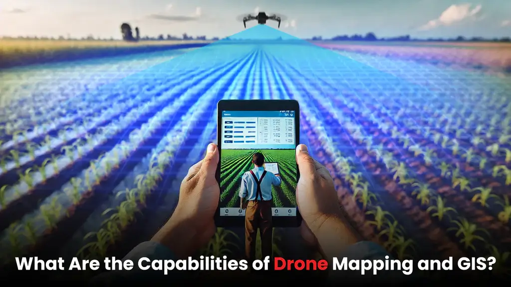
GIS Mapping Using Drones: Applications in Urban Planning

GIS mapping using drones is rapidly transforming the way urban planning is approached in modern cities. As urban areas expand and infrastructure becomes more complex, planners and government authorities need accurate, real-time spatial data to make informed decisions. Traditional land surveys and mapping methods are often time-consuming, expensive, and limited in scope. According to recent industry standards for precision aerial surveying, the ROI of drone tech is rising

What Is GIS Mapping Using Drones?
Drone-led geographic analysis combines unmanned aerial vehicles (UAVs) with Geographic Information Systems to collect, process, and analyze geospatial data. Drones capture high-resolution aerial imagery, LiDAR data, and terrain models, which are then integrated into GIS platforms for detailed analysis and visualization.
This technology enables urban planners to view cities from a data-driven perspective, supporting better planning, monitoring, and management of urban environments.
Why Urban Planning Needs Drone-Based GIS Mapping
Urban planning involves land use analysis, infrastructure development, environmental management, and population growth planning. GIS mapping drones provides planners with up-to-date and accurate spatial data that traditional methods often fail to deliver.
Key challenges solved by drone-based GIS mapping include:
- Incomplete or outdated maps
- Limited visibility of large urban areas
- Slow data collection processes
- High survey and manpower costs
By adopting GIS mapping drones, urban authorities gain real-time insights that improve planning accuracy and execution.
Key Applications of Drone-led geographic analysis in Urban Planning
1. Land Use and Zoning Analysis
Drone-led geographic analysis helps planners assess current land use patterns and identify suitable zones for residential, commercial, industrial, and green spaces. High-resolution data ensures zoning decisions are based on actual ground conditions.
2. Infrastructure Planning and Development
Roads, bridges, drainage systems, and public utilities require precise spatial planning. GIS mapping drones enables accurate measurement of distances, elevations, and terrain features, supporting efficient infrastructure design and development.
3. Smart City Development
Smart cities rely heavily on data-driven decision-making. GIS mapping drones supports smart city initiatives by providing detailed spatial datasets for traffic planning, utility management, and digital city models.
4. Urban Expansion and Growth Monitoring
Cities grow rapidly, often beyond planned boundaries. GIS mapping drones allows authorities to monitor urban sprawl, identify unauthorized developments, and plan sustainable expansion strategies.
5. Environmental and Green Space Management
Urban sustainability is a growing priority. GIS mapping drones helps planners monitor green spaces, water bodies, and environmental changes, enabling better conservation and climate-resilient planning.
6. Disaster Management and Risk Assessment
Urban areas are vulnerable to floods, landslides, and earthquakes. GIS mapping drones provides critical data for risk assessment, emergency planning, and post-disaster damage analysis, helping cities respond faster and more effectively.
Benefits of Photogrammetric mapping for Urban Planning
The adoption of GIS drones offers multiple advantages:
- High Accuracy: Detailed and precise spatial data
- Speed: Faster data collection compared to traditional surveys
- Cost Efficiency: Reduced manpower and fieldwork costs
- Safety: Minimal on-ground risk in dense urban environments
- Scalability: Easy mapping of large or complex city areas
These benefits make Photogrammetric mapping an essential tool for modern urban development.
Role of Professional Drone Service Providers
To fully leverage GIS mapping drones, urban planners and government bodies should work with experienced drone service providers. Professional providers ensure:
- Regulatory compliance
- Advanced data processing and analysis
- Accurate GIS integration
- Actionable planning insights
This ensures drone data is not just collected, but transformed into meaningful planning intelligence.
Conclusion
Drone-led geographic analysis is redefining urban planning by delivering accurate, timely, and actionable geospatial data. From land use planning to smart city development and environmental monitoring, drone-based GIS solutions empower planners to build sustainable, efficient, and future-ready cities.
As urban challenges continue to grow, GIS mapping drones
will remain a critical technology driving smarter and more transparent urban planning decisions.