- Services
- All Services
- All Locations
- Surveying
- Drone Infrastructure Services
- Drone Services for Agriculture
- Drone Inspection for Cell Towers
- Drone Media Services
- Drone Mapping Services
- Drone Mining Inspection
- Drone for Surveillance And Security
- Industrial Robotics and Unmanned Systems
- Semiconductor Design and Innovation Services
- Factory Automation Solutions
- Portfolio
- Unmanned Products
- Drone Training
- Blog
- Brochure
- Contact us
How Drones Improve Transparency in Public Infrastructure Projects
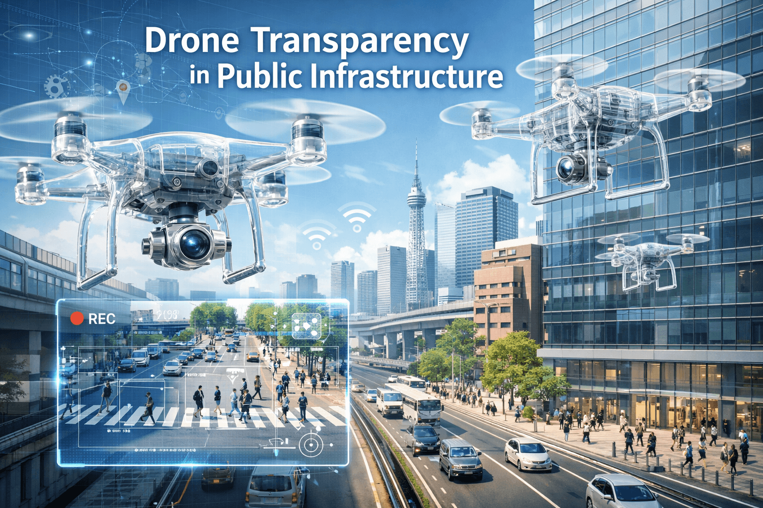
Drone transparency in public infrastructure projects is becoming a critical requirement as governments and public agencies face increasing pressure for accountability, efficiency, and timely delivery. Large-scale infrastructure projects often involve multiple contractors, long timelines, and public funding—making transparency essential at every stage.
By providing real-time, visual, and data-driven insights, drone transparency in public infrastructure projects is transforming how progress is tracked, reported, and verified.
Why Transparency Matters in Public Infrastructure
Public infrastructure projects such as roads, bridges, metros, utilities, and smart city developments directly impact citizens and involve significant public investment. However, traditional reporting methods often rely on manual updates, delayed site visits, and subjective assessments.
Common transparency challenges include:
- Delayed progress reporting
- Limited on-ground visibility
- Discrepancies between reports and actual work
Difficulty in auditing large project areas
This is where drone transparency in public infrastructure offers a reliable and objective solution.
Real-Time Visibility Into Project Progress
One of the biggest advantages of drone transparency in public infrastructure projects is real-time visibility. Drones can capture high-resolution aerial data across large project sites within hours.
This allows authorities and stakeholders to:
- Monitor actual progress against timelines
- Identify delays or deviations early
- Access site updates without physical visits
- Maintain continuous oversight
Real-time visual evidence reduces dependency on manual reporting and increases trust in project data.
Objective and Verifiable Data Collection
Manual reports can be influenced by human error or bias. Drone transparency in public infrastructure introduces objective, data-backed documentation through time-stamped and geo-referenced imagery.
Drone data provides:
- Unalterable visual records
- Accurate measurements and comparisons
- Clear documentation of work completed
- Reliable inputs for audits and reviews
This ensures that decisions are based on facts, not assumptions.
Improved Accountability Across Contractors
Public infrastructure projects often involve multiple contractors and agencies. Drone transparency in public infrastructure helps clearly define accountability by recording who completed what work and when.
Benefits include:
- Reduced disputes between contractors
- Clear responsibility for delays or defects
- Performance tracking over time
- Improved coordination between stakeholders
This level of accountability improves project governance and execution quality.
Supporting Audits and Compliance Reporting
Audits are a major challenge in public projects due to the scale and complexity involved. Drone transparency in public infrastructure simplifies audits by providing consistent and standardized visual records.
Drone-based documentation supports:
- Compliance with safety and construction standards
- Environmental monitoring and reporting
- Financial audits linked to work completion
- Faster and smoother audit processes
Regulatory bodies increasingly accept drone data as valid audit evidence.
Enhancing Public Trust and Confidence
Transparency is directly linked to public trust. When citizens know that projects are being monitored objectively, confidence in governance increases. Drone transparency infrastructure allows authorities to share verified progress updates with the public.
This can include:
- Visual progress reports
- Before-and-after comparisons
- Transparent milestone tracking
Such openness strengthens public confidence and reduces misinformation.
Reducing Delays and Cost Overruns
Lack of transparency often leads to unnoticed delays and cost escalations. Drone transparency in public infrastructure helps identify issues early, enabling corrective action before problems grow.
Early detection supports:
- Better schedule control
- Reduced rework
- Improved budget management
- Faster issue resolution
This proactive approach saves both time and public funds.
Scalable Monitoring Across Large Regions
Public projects often span cities, states, or regions. Drone transparency makes large-scale monitoring practical and cost-effective.
Drones can:
- Cover vast areas quickly
- Standardize monitoring across sites
- Provide centralized reporting dashboards
- Reduce manpower requirements
This scalability makes drones ideal for national and state-level infrastructure programs.
The Role of Professional Drone Service Providers
To fully achieve drone transparency, government bodies and agencies must work with experienced and compliant drone service providers.
Professional providers ensure:
- Regulatory compliance
- Accurate data capture and processing
- Secure data handling
- Actionable insights, not just images
This partnership turns drone data into a powerful transparency tool.
Conclusion
Drone transparency in public infrastructure is redefining how governments monitor progress, ensure accountability, and build public trust. By offering real-time visibility, objective data, and reliable documentation, drones bridge the gap between planning and reality.
As public infrastructure projects grow in scale and complexity, drone-based transparency is no longer optional—it is essential for responsible governance and efficient project delivery.