- Services
- All Services
- All Locations
- Surveying
- Drone Infrastructure Services
- Drone Services for Agriculture
- Drone Inspection for Cell Towers
- Drone Media Services
- Drone Mapping Services
- Drone Mining Inspection
- Drone for Surveillance And Security
- Industrial Robotics and Unmanned Systems
- Semiconductor Design and Innovation Services
- Factory Automation Solutions
- Portfolio
- Unmanned Products
- Drone Training
- Blog
- Brochure
- Contact us
Blog

5 Ways AI-Powered Drones Are Revolutionizing Smart Factories
Smart factories are evolving fast, driven by Industry 4.0 technologies such as artificial intelligence, automation, and connected systems. Among these innovations, AI-powered drones are emerging[…]
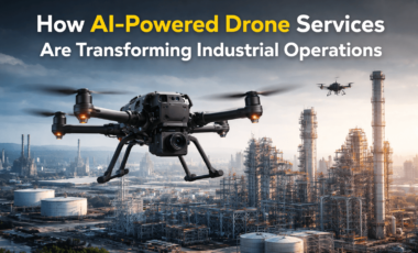
How AI-Powered Drone Services Are Transforming Industrial Operations
AI-Powered Drone Services Are Transforming Industrial Operations Industrial operations are becoming increasingly complex, requiring precise monitoring, faster inspections, and enhanced safety. Traditional inspection and monitoring[…]
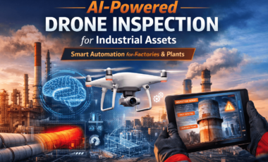
AI-Powered Drone Inspection for Industrial Assets:
AI-Powered Drone Inspection for Industrial Assets: A Smarter Way to Inspect Industrial Infrastructure Industrial assets like factories, power plants, chimneys, pipelines, and large industrial structures[…]
What Is A “Drone Inspection”?
Drones Have Become An Important Tool For Inspecting An Industry’s Safety, Reliability, And Efficiency In today’s world, drones are providing a solution for companies that[…]
Surveying & Aerial Technology Insights
The Truncated Version Of Surveying & Aerial Technology Insights, As Used Today, In Mining, Construction, And Environmental Sectors. Surveying & Aerial Technology Insights have become[…]
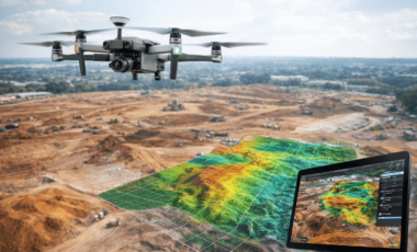
Drone Mapping
Drone Mapping is the New Way To Accurately Gather Geographic Information In just a short time aerial data collection has evolved quite a little bit[…]
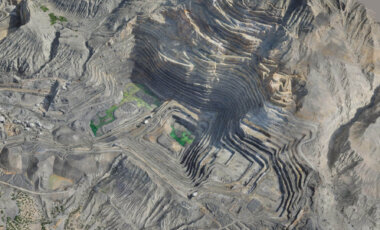
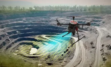
Greater Accuracy and Efficiency in Mining Operations
From Improved Workplace Safety to Greater Accuracy and Efficiency in Mining Operations Due to the increased implementation of technology in the mining sector, many mining[…]

What is Drone Service and How Do They Work ?
What is Drone Service and How Do They Work? Drone Technology has changed how businesses collect data and visuals, as well as inspect their assets.[…]
Best Factory Automation Solutions in India
How to Select the Right Drone Service Company for Your Project Best Factory Automation Solutions in India Factory automation is changing fast in India, and[…]
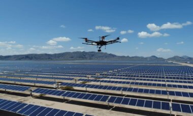
Drone Inspection for Solar Power Plants: Benefits & ROI
Drone Inspection for Solar Power Plants: Benefits & ROI Solar power plants require regular inspections to maintain efficiency, detect faults early, and reduce energy losses.[…]