- Services
- All Services
- All Locations
- Surveying
- Drone Infrastructure Services
- Drone Services for Agriculture
- Drone Inspection for Cell Towers
- Drone Media Services
- Drone Mapping Services
- Drone Mining Inspection
- Drone for Surveillance And Security
- Industrial Robotics and Unmanned Systems
- Semiconductor Design and Innovation Services
- Factory Automation Solutions
- Portfolio
- Unmanned Products
- Drone Training
- Blog
- Brochure
- Contact us
LiDAR in Modern Aerial Surveying Is Transforming Precision Mapping
LiDAR in modern aerial surveying has become one of the most powerful technologies driving accuracy and efficiency in drone-based mapping solutions. As industries demand higher precision and faster data processing, LiDAR-equipped drones are replacing many traditional surveying methods. From infrastructure planning to environmental analysis, this technology is redefining how geospatial data is captured and interpreted.
In today’s competitive landscape, accurate terrain models and reliable data insights are critical. That’s where LiDAR-powered aerial systems deliver unmatched performance.
What Is LiDAR and How Does It Work?
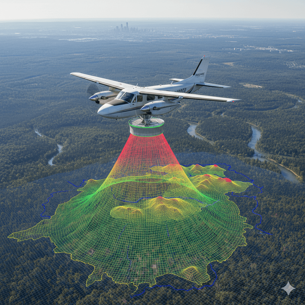
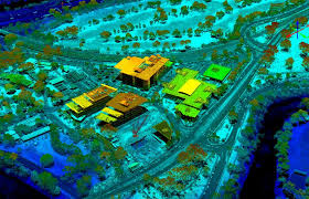
LiDAR (Light Detection and Ranging) is a remote sensing technology that uses laser pulses to measure distances between the sensor and the Earth’s surface. When mounted on drones, LiDAR systems emit thousands of laser pulses per second. These pulses bounce back after hitting objects, and the return time is calculated to create precise 3D maps.
LiDAR in modern aerial surveying works effectively because it can:
- Capture highly accurate elevation data
- Penetrate vegetation to measure ground level
- Generate detailed point clouds
- Produce high-resolution 3D terrain models
- Operate in low-light conditions
This makes LiDAR superior in scenarios where photogrammetry may face limitations.
Why LiDAR Is Essential in Modern Surveying Solutions
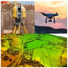
The growing demand for reliable geospatial intelligence has increased the importance of LiDAR in modern aerial surveying. Traditional surveying methods can be time-consuming and labor-intensive. Even drone-based photogrammetry, while effective, may struggle in dense vegetation or uneven terrain.
LiDAR provides advantages such as:
High Accuracy
Centimeter-level precision makes LiDAR ideal for infrastructure and engineering projects.
Faster Data Collection
Large areas can be mapped in significantly less time compared to ground surveys.
Vegetation Penetration
Unlike standard imaging systems, LiDAR can measure terrain beneath forest canopies.
Consistent Results
Laser-based measurement ensures consistent and reliable datasets.
These benefits explain why LiDAR in modern aerial surveying is increasingly becoming the preferred choice for professional surveyors.
Key Applications of LiDAR in Aerial Surveying
Infrastructure Development
LiDAR data supports road design, railway alignment, and bridge inspections with highly accurate elevation models.
Mining & Aggregates
Surveyors use LiDAR in modern aerial surveying to calculate stockpile volumes, monitor excavation progress, and assess terrain changes.
Environmental Monitoring
Forest density analysis, watershed mapping, and flood modeling benefit greatly from LiDAR precision.
Urban Planning
Smart city development requires detailed 3D city models that LiDAR technology can efficiently provide.
Utility & Energy
Power line corridor mapping and wind farm site assessments rely on accurate topographic data.
How LiDAR Improves Project Efficiency
One of the biggest reasons companies invest in LiDAR in modern aerial surveying is operational efficiency. By reducing field time and automating data collection, project timelines shrink significantly.
Additionally:
- Fewer ground control points are required
- Reduced manual labor costs
- Faster post-processing through cloud platforms
- Improved decision-making with real-time data access
These factors directly contribute to better ROI for large-scale projects.
The Future of LiDAR in Aerial Surveying
As drone technology continues to evolve, LiDAR in modern aerial surveying will become even more advanced. Innovations expected in the coming years include:
- Lightweight LiDAR sensors for longer flight times
- AI-powered real-time point cloud processing
- Integration with digital twin platforms
- Autonomous drone fleets equipped with LiDAR
The combination of AI, cloud computing, and LiDAR technology will further enhance the efficiency and intelligence of aerial surveys.
Conclusion
The growing adoption of LiDAR in modern aerial surveying reflects the industry’s need for precision, speed, and reliability. Whether it is infrastructure planning, mining operations, environmental studies, or urban development, LiDAR-enabled drones are delivering unmatched mapping capabilities.
Organizations that integrate LiDAR into their aerial surveying solutions gain not only accurate data but also a competitive advantage in project execution and decision-making.
As technology advances, LiDAR will continue to play a central role in shaping the future of aerial intelligence.