- Services
- All Services
- All Locations
- Surveying
- Drone Infrastructure Services
- Drone Services for Agriculture
- Drone Inspection for Cell Towers
- Drone Media Services
- Drone Mapping Services
- Drone Mining Inspection
- Drone for Surveillance And Security
- Industrial Robotics and Unmanned Systems
- Semiconductor Design and Innovation Services
- Factory Automation Solutions
- Portfolio
- Unmanned Products
- Drone Training
- Blog
- Brochure
- Contact us
Self-Flying UAVs for Survey & Mapping Are Redefining Aerial Intelligence
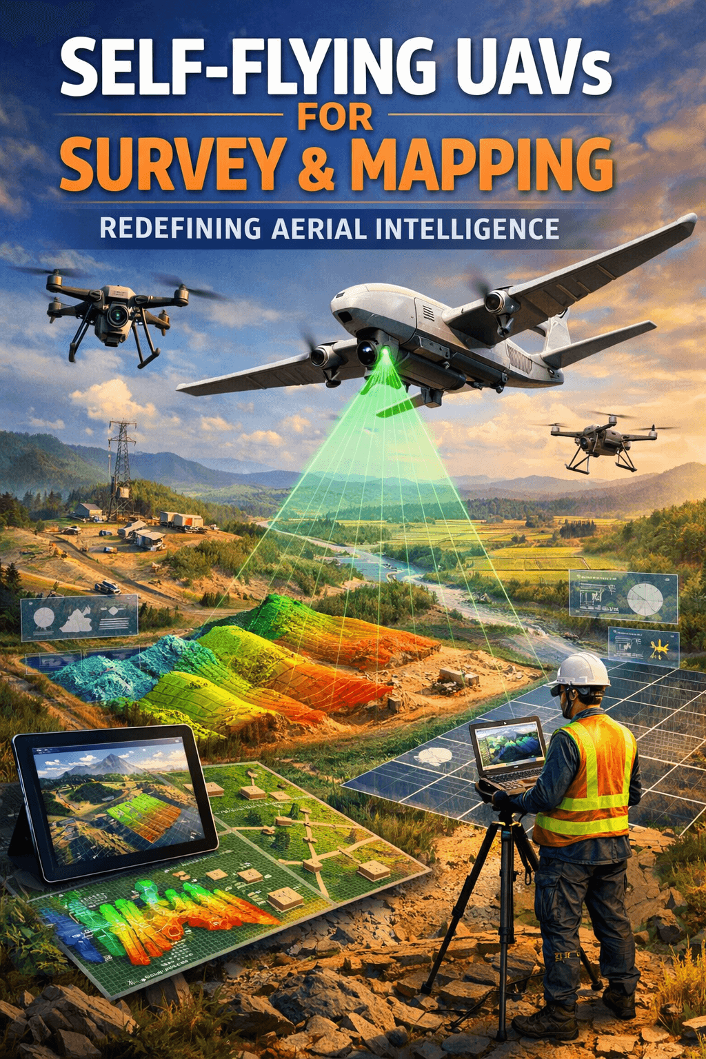
Self-flying UAVs for survey & mapping are transforming how industries collect, analyze, and use geospatial data in 2026. What once required manual drone piloting, multiple operators, and hours of post-processing is now being handled by intelligent, autonomous systems capable of planning routes, avoiding obstacles, and delivering highly accurate results with minimal human intervention.
As drone autonomy advances, industries like construction, mining, infrastructure, agriculture, and urban planning are rapidly adopting self-operating aerial solutions. These smart drones are not just flying machines — they are becoming independent data-collection systems powered by AI, machine learning, and real-time analytics.
What Are Self-Flying UAVs?
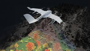
Unlike traditional drones that require constant manual control, self-flying UAVs for survey & mapping use autonomous flight planning software, GPS RTK systems, onboard AI processors, and obstacle detection sensors to complete missions independently.
Once mission parameters are set, the drone:
- Automatically generates optimal flight paths
- Adjusts altitude based on terrain
- Avoids obstacles in real time
- Captures high-resolution geospatial data
- Returns safely without manual intervention
This level of automation reduces human error and ensures consistent data quality across projects.
Why Drone Autonomy Is Rising in 2026
Several technological advancements are accelerating the adoption of self-flying UAVs for survey & mapping:
1. AI-Based Flight Intelligence
Modern UAVs use AI algorithms to optimize flight efficiency and coverage. They adapt to environmental conditions, improving data precision.
2. RTK & PPK Accuracy
With centimeter-level positioning accuracy, autonomous drones now meet professional survey-grade standards.
3. Cloud-Based Data Processing
Captured data is automatically uploaded and processed using cloud platforms, significantly reducing turnaround time.
4. Regulatory Support
In countries like India, drone regulations are becoming more structured, encouraging commercial adoption of autonomous UAV systems.
Benefits of Self-Flying UAVs for Survey & Mapping
Increased Efficiency
Autonomous drones cover large areas faster than manual operations, saving time and labor costs.
Improved Accuracy
Consistent flight paths ensure uniform data capture, making survey & mapping highly reliable for precision projects.
Enhanced Safety
Surveying hazardous areas like mines, highways, or construction zones becomes safer with minimal human exposure.
Cost Optimization
Fewer operators and reduced operational errors lead to long-term cost savings.
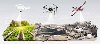
Industry Applications in 2026
The adoption of self-flying UAVs for survey & mapping is expanding across industries:
- Construction: Site progress monitoring and volumetric calculations
- Mining: Stockpile measurement and terrain mapping
- Infrastructure: Road and railway corridor surveys
- Agriculture: Land mapping and crop health analysis
- Urban Planning: Smart city development and land-use mapping
These applications highlight how drone autonomy is becoming essential for modern infrastructure development.
How Self-Flying UAVs Improve Data Quality
Autonomous UAV systems eliminate inconsistencies caused by manual flight variations. With predefined overlap ratios, consistent altitude control, and AI-driven stabilization, self-flying UAVs for survey & mapping produce:
- High-resolution orthomosaic maps
- Accurate 3D terrain models
- Digital Surface Models (DSM)
- Digital Elevation Models (DEM)
The precision level now rivals traditional land surveying methods while being significantly faster.
The Future of Autonomous Drone Surveying
Looking ahead, self-flying UAVs for survey & mapping will become even smarter with:
- Swarm drone technology
- Edge computing integration
- Real-time 3D mapping
- Autonomous charging stations
- AI-based predictive terrain analysis
In 2026 and beyond, drone autonomy will shift from being a competitive advantage to becoming an industry standard.
Final Thoughts
The rise of self-flying UAVs for survey & mapping marks a major shift in how geospatial intelligence is gathered and utilized. As AI-driven autonomy continues to evolve, businesses that adopt these technologies early will gain faster insights, improved operational efficiency, and stronger decision-making capabilities.
Drone autonomy is no longer just innovation — it is the future of surveying and mapping.