- Services
- All Services
- All Locations
- Surveying
- Drone Infrastructure Services
- Drone Services for Agriculture
- Drone Inspection for Cell Towers
- Drone Media Services
- Drone Mapping Services
- Drone Mining Inspection
- Drone for Surveillance And Security
- Industrial Robotics and Unmanned Systems
- Semiconductor Design and Innovation Services
- Factory Automation Solutions
- Portfolio
- Unmanned Products
- Drone Training
- Blog
- Brochure
- Contact us
What is Drone Mapping and How Does It Work?
What is Drone Mapping and How Does It Work?
Technology has changed the way we see the world. One of the most exciting tools today is Drone Mapping. In the past, people used big machines or even walked long distances to measure land. Now, we can use drones to do the same work faster, easier, and with more accuracy.
But what is Drone Mapping, and how does it work? Let’s understand step by step.
What is Drone Mapping?
Drone Mapping means using drones to take pictures of the land from the sky and then turning those pictures into useful maps. These maps can show the size of an area, the height of objects, or even 3D models of buildings and landscapes.
Instead of using paper maps or heavy survey tools, drones make the job smarter. Drone mapping uses Unmanned Aerial Vehicles (UAVs) that fly above the ground and capture hundreds of images. With the help of drone mapping software, these images are joined together to create detailed maps.
How Does Drone Mapping Work?
The process of drone mapping and surveying is simple but powerful. Here are the main steps:
-
Planning the Flight
The first step is to plan where the drone will fly. With drone mapping software, you can mark the area on a computer or tablet. -
Flying the Drone
The drone, also called a UAV, flies over the selected area. During the flight, it takes many photos from different angles. -
Collecting Data
Each picture taken by the drone has details like location (GPS data) and altitude. -
Processing the Data
After the flight, all the photos are uploaded into drone mapping software. The software puts them together like puzzle pieces to make a full map. -
Creating Maps and Models
The final result can be a 2D map, a 3D model, or even a measurement report that can be used for building, farming, or research.
This process is called a drone mapping survey, and it is much faster than traditional surveys.
Benefits of Drone Mapping
There are many reasons why people are turning to drone mapping services today. Let’s look at some key benefits:
-
Fast and Accurate – A drone mapping survey can cover large areas quickly with high accuracy.
-
Cost-Effective – Hiring a drone is often cheaper than using helicopters or manual labor.
-
Safe – Drones can fly in places that may be dangerous for humans, like steep mountains or construction sites.
-
Detailed Data – The maps created are rich in detail and can be used for many purposes.
Drone Mapping in Different Industries
Drone Mapping is not just for one type of work. It is useful in many industries. Here are some common examples:
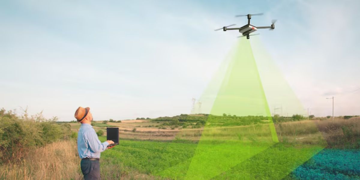
1. Agriculture
Farmers use drone mapping services to check crop health, measure field sizes, and even plan irrigation systems. A drone mapping survey shows which parts of the land need more water or fertilizer.
2. Construction
Builders use drone mapping and surveying to check land before starting projects. They can also track progress during construction. It saves time and ensures accuracy.
3. Mining
Mines are often in dangerous areas. Drone mapping uses Unmanned Aerial Vehicles (UAVs) to safely measure stockpiles, monitor blasting, and calculate material volumes.
4. Environmental Studies
Scientists use drone mapping to study forests, rivers, and climate changes. It helps them protect nature and plan better.
5. Real Estate
Property developers use drone mapping software to create beautiful layouts for customers. Aerial views make it easy to showcase land and housing projects.
Drone Mapping Software
Without good software, drones are just flying cameras. Drone mapping software is what turns photos into useful maps. Some popular features include:
-
Stitching images together.
-
Creating 3D models of land and buildings.
-
Measuring distance, area, and volume.
-
Exporting maps into formats that engineers or architects can use.
The right software makes drone mapping services more professional and reliable.
Drone Mapping vs. Traditional Surveying
Traditional surveying takes a lot of time and manpower. Surveyors often walk long distances with tools to measure land. While accurate, it is slow and costly.
In comparison, drone mapping and surveying is much faster. A drone can map the same land in a few hours, giving results that are easy to understand. This is why companies are shifting to drone mapping survey methods.
Challenges in Drone Mapping
Like all technology, Drone Mapping also has some challenges:
-
Weather problems like rain or strong winds can stop flights.
-
Drones need trained pilots.
-
Software requires good computers and internet.
-
Some areas may need government permissions to fly drones.
Still, the benefits are much higher than the challenges.
Future of Drone Mapping
The future of drone mapping services looks very bright. With better cameras, stronger drones, and smarter software, the maps will become even more detailed.
Soon, drones may also use Artificial Intelligence (AI) to analyze maps in real time. This will make drone mapping and surveying faster and more accurate than ever.
Conclusion
Drone Mapping has changed the way we measure and understand the world. From farming to construction, mining to environment, it plays a huge role in modern life. By using drone mapping survey methods, businesses can save time, money, and effort. With the help of drone mapping software, drones turn simple pictures into powerful maps. And since drone mapping uses Unmanned Aerial Vehicles (UAVs), the process is safe and effective.
For anyone looking for trusted and professional support, Dronitech is the Provide best drone mapping services.
Visit us – https://maps.app.goo.gl/e6eBwHCzwBjxJung9