- Services
- All Services
- All Locations
- Surveying
- Drone Infrastructure Services
- Drone Services for Agriculture
- Drone Inspection for Cell Towers
- Drone Media Services
- Drone Mapping Services
- Drone Mining Inspection
- Drone for Surveillance And Security
- Industrial Robotics and Unmanned Systems
- Semiconductor Design and Innovation Services
- Factory Automation Solutions
- Portfolio
- Unmanned Products
- Drone Training
- Blog
- Brochure
- Contact us
Use of drone technology for thermal inspections
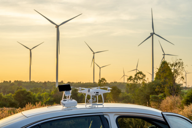
Annual wind-turbine blade and tower inspections by drone increase the safety, efficiency, and accuracy of inspection service. Thermal testing refers to a non-destructive inspection process that uses specialized cameras that can detect infrared radiation. The process measures minute temperature differences that are typically invisible to the human eye and can provide an extremely detailed image.
There are some advantages of thermography for turbine maintenance includes
- Prevents costly downtime
- Improves return on investment
- Quick and efficient scanning of large objects
- Repair components before failure occur
- Direct contact with the object is not required
Thermal imaging plays an important role in wind turbine maintenance programs. Like all other equipment, the components in a turbine are susceptible to wear and can break down. Both electrical and mechanical components getting hot before it fails. A thermography survey with drones can spot this rise in temperature before failure occurs, detecting wear on bearings, shafts, gears, and brakes in a less period of time.
Dronitech is a national leader in providing drone services & training across India. Our drones capture detailed data in order to identify, classify and localize each anomaly, and understand the impact of its performance on the system.
Using drone inspection solution from Dronitech for visual inspection of wind turbines provides benefits such as:
- Reduced downtime and increase production time
- Greatly reduce man-hours by automating inspections
- Provides high-quality images and video
- Drones collect needed data for identifying and mitigating risks
- Reveals damage to the wind turbine blades
- Authorized and qualified inspection personnel
- Preventive maintenance planning and optimized production
- Digitizing Infrastructure Through Drone Data Capture
Dronitech has effective thermal imaging and some powerful techniques to capture engineering-grade levels of accuracy for use in analytics for generations.
Get started with Dronitech today
Dronitech UAV services to measure projects at any angle including aerial photography, mapping, surveying, industrial inspection and video. Visit https://www.dronitech.com/ Or you can request a consultation with one of our team members.